News Summary
The Treasure Coast is under a Tropical Storm Watch as Tropical Depression Nine nears South Florida, prompting local authorities to advise residents to prepare for severe weather. While no school closures have been announced, St. Lucie Public Schools is monitoring the situation closely. The National Hurricane Center indicates that the storm may strengthen into a tropical storm and potentially a hurricane over the weekend, bringing heavy rain and gusty winds to coastal areas. Residents are urged to review hurricane preparedness plans.
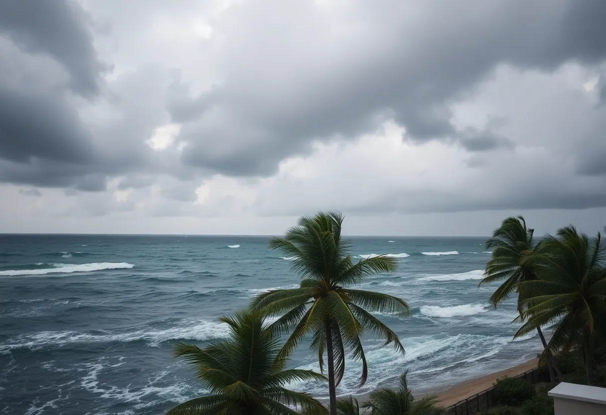
Fort Pierce, FL – The Treasure Coast is currently under a Tropical Storm Watch as Tropical Depression Nine approaches South Florida. This weather system has been tracked moving closer to the region, prompting local authorities to advise residents to prepare for possible severe weather conditions, including gusty winds, heavy rainfall, and hazardous surf.
No school closures have been announced for area districts amidst the unfolding weather situation. St. Lucie Public Schools is actively monitoring the storm’s progress and reports no anticipated changes to normal school operations for the upcoming week. Parents and caregivers can expect that regular before- and after-school programs will continue as planned. District leaders maintain ongoing communication with the St. Lucie County Emergency Operations Center to stay updated on any potential impacts from the storm.
Families are encouraged to remain informed about the situation by checking the St. Lucie Public Schools website, following its social media channels, and monitoring local news reports. This will ensure that they are up to date on any announcements or changes caused by Tropical Depression Nine.
Storm Details and Forecast
The National Hurricane Center (NHC) has projected that Tropical Depression Nine, which formed between the central Bahamas and eastern Cuba, will likely strengthen into a tropical storm over the weekend. Current forecasts indicate that the storm could become a hurricane as it tracks northward just offshore of Florida’s Atlantic coast.
As of the latest advisories, the NHC has confirmed that the storm has developed a more organized circulation with sustained winds nearing 35 mph. Tropical Storm Watches have been issued for the coastal areas of Martin, St. Lucie, and Indian River counties, and Tropical Storm Warnings are already in effect for the waters from Jupiter Inlet to Deerfield Beach and across the Bahamas.
Forecasts suggest that the storm’s trajectory will carry it northwest across the Bahamas, paralleling the eastern coast of Florida. Although the storm center is anticipated to remain offshore, significant impacts are likely, including strong winds, dangerous rip currents, and heavy rainfall beginning late Sunday into Monday.
Expected Weather Impacts
Rainfall projections for coastal Florida range from 1 to 3 inches, with certain areas possibly experiencing totals exceeding 4 inches. As the storm approaches, it is expected to bring severe weather conditions, particularly over the weekend into early next week. The NHC has warned residents of a high risk for rip currents, especially from Sunday into Monday, as wind and rain are anticipated to peak during this time.
Residents are advised to review their hurricane preparedness plans and maintain vigilance, especially if forecasts indicate potential changes that may direct the storm closer to the coast. Observers note the possibility of the storm stalling off the Southeast coast, which could lead to further impacts in the Carolinas and Mid-Atlantic regions later in the week.
The NOAA Hurricane Hunter aircraft are actively monitoring the developments of this system, which is also expected to contribute to heavy rain across Hispaniola, eastern Cuba, Jamaica, and the Bahamas. In mountainous areas, this may heighten the risks of flash floods and mudslides.
As the situation evolves, local officials are emphasizing the importance of safety and preparedness for residents along the Treasure Coast. With breakable waves expected to reach heights between 6 to 8 feet, authorities caution against high surf and boating dangers.
As the storm continues on its path, keeping informed through reliable channels will be essential for residents and families on the Treasure Coast. Awareness and readiness can help mitigate the risks associated with extreme weather events like Tropical Depression Nine.
Deeper Dive: News & Info About This Topic
HERE Resources
Additional Resources
- WPTV: Schools Monitoring Tropical Storm Watch
- Wikipedia: Tropical storm
- WPBF: Florida Tropical Storm Watch
- Google Search: Tropical Storm Watch
- Boca Raton Tribune: Tropical Depression Forms
- Encyclopedia Britannica: Hurricane
- Florida Today: Tropical Storm Watch Issued
- Google News: Tropical Depression Nine